April 4, 2017
Day 6 found us packing everything back into the Mercedes and taking leave of The Ashville Mews and of Bristol. We planned to use this day to visit the medieval town of Bath. Founded by the Romans around 60AD, they created a bathing complex around the hot springs found in the area. It may, in fact, have been the site of the Battle of Badon in which King Arthur defeated the Anglo-Saxons. In the early 5th century, the baths fell into disrepair and were lost to the rising water levels and silting. However, the name Badon, meaning “at the baths”, remained and became the source of the city’s present name. The baths were rediscovered and, in the 12th century began expanding. The original baths were closed to use in the late 1970s when a young girl contracted meningitis and died and, subsequently, an extremely dangerous disease-causing amoeba was found in the water. Due to time constraints, we passed on the tour of the baths and chose to visit the Abbey. (I had visited the baths on my trip back in 1988 but did not have time to tour the Abbey.)
Adjacent to the baths is the Abbey Church of Saint Peter and Saint Paul, commonly known as the Bath Abbey or Bath Cathedral. Founded in the 7th century, the Abbey is cruciform in design and can seat 1200 worshippers. It, along with the town, passed through many hands, including the Crown over the years. A major renaissance of the building occurred in the 19th century including the addition of flying buttresses to the Nave.
I should take a moment to update you on the mapping app we were using in lieu the car GPS. Though I thought I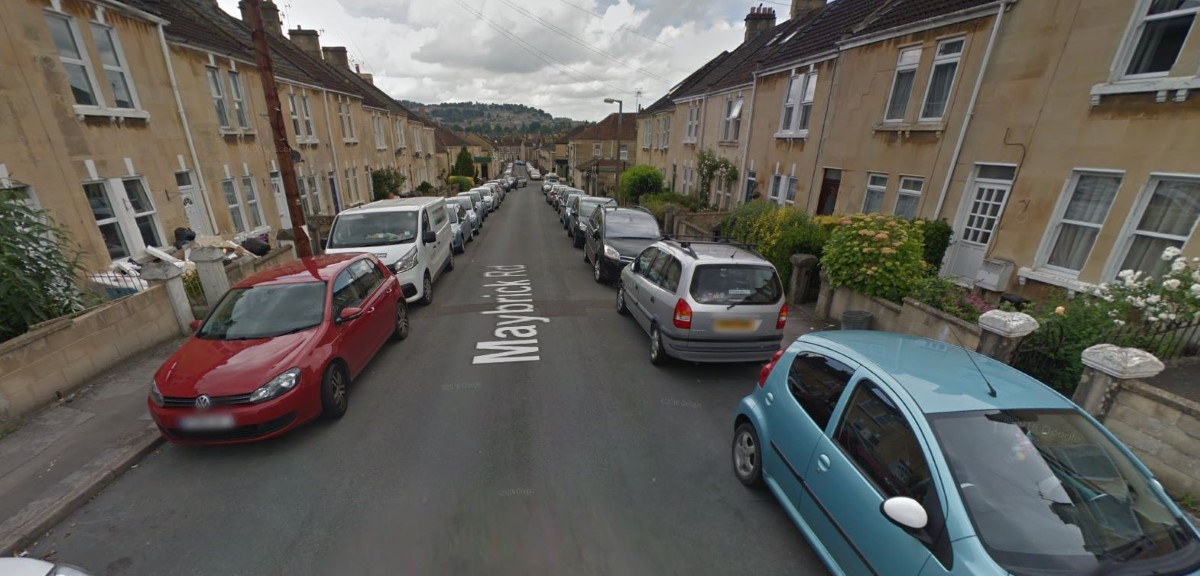 had loaded the entire map of England, apparently it was just the Bristol area. So I was unable to program the route to Bath into the app. I had set up the driving route on Google Map on my laptop before leaving Bristol. However as we were no longer connected to the Internet, as John attempted to scroll it, it went blank and as we approached Bath, we were flying virtually blind. Unfortunately, we made a wrong turn and wound up in a hilly residential area. Being Sunday afternoon, most of the autos were parked -
 lining both sides of the narrow streets which I had to thread like a needle. It took us some time to find our way back to a recognizable point but I was finally able to navigate to a parking garage. I did not think to take a picture of the street situation (all of my mental energy was concentrating on keeping it between the cars) but I have captured a picture from Google Street that might give you an idea.
With the PS part of my GPS turning to BS, I was forced to obtain a new, but primitive, GPS - a road map of southern England. With this in hand, we were able to find our way out of Bath with only a single wrong turn and on the road to Stonehenge. It was a lovely drive through rural England with its rolling hills and fields of yellow wildflowers. The yellow wildflowers reminded me of the fields of buttercups I love so much in the southern US but I noticed that they were much taller with kind of a bushy flower. The rolling hills soon transformed to the flatter land of the Salisbury Plain and I knew we were not far from Stonehenge.
I visited Stonehenge during my trip back in 1988. At that time, I parked in the sm.jpg) all car park across the A303 from the Stones and walked through the short tunnel to the site. There was a circular path roped off maybe 60-
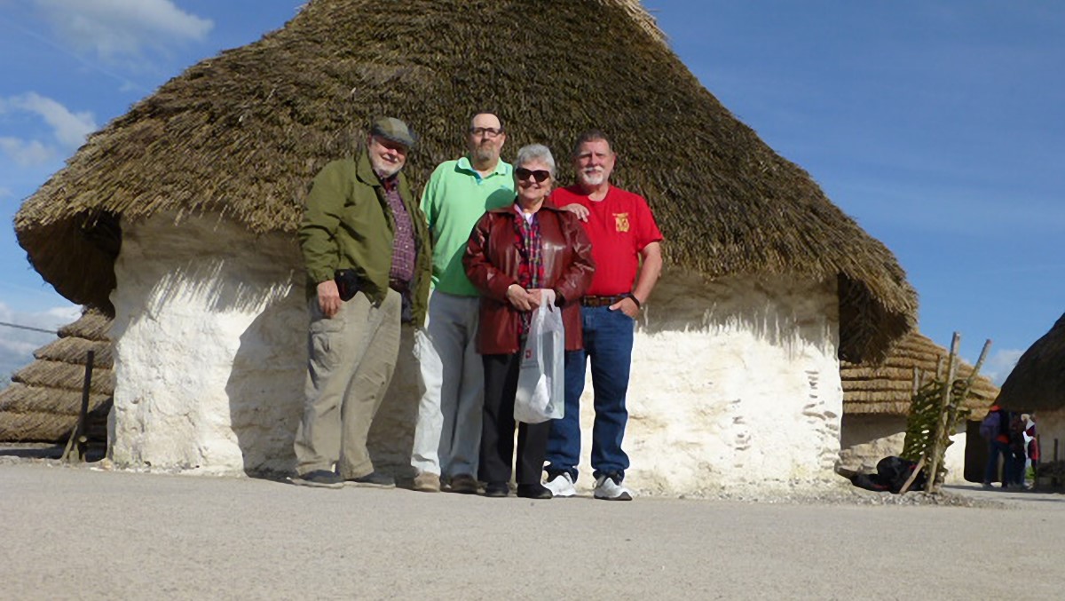
all car park across the A303 from the Stones and walked through the short tunnel to the site. There was a circular path roped off maybe 60-80 feet from the stones with plaques periodically explaining the development of the Stones. If I remember correctly, the pathway was inside the ditch that surrounds the Stones. On that day, there could not have been more than 2-3 dozen people total. Today the car park is no more. Instead, a new Visitor Center has been erected about 1.5mi away and we had to catch a shuttle bus to the site. Once there, we were directed to a roped off path outside of the ditch and 150+ feet from the nearest stone. And there were at least a hundred people, possibly two, at the site. In the future you will probably sit in a booth in the Visitor Center with head phones, stereo goggles and sensory gloves. But at least you will be able to “get close and touch” the Stones. Come to think of it, you won’t even have to be in England to do this.
For those few of you who are not familiar with Stonehenge, it is a prehistoric monument lying on the Salisbury Plain near Amesbury approximately half way between London and Bristol. Earliest use of the site as a burial location dates to the Mesolithic period, about 8000 BC. The stone remnants we see today were constructed during the Neolithic period from 3000 BC to 2000 BC and consist of a partial circle of stones weighing about 25 tons each with lintel stones atop. Inside this is a circle of smaller stones which surround a set of larger stones set in a horseshoe pattern and finally a single alter stone. The entire structure is surrounded by a shallow ditch. The site was held in private ownership until 1918 when Cecil Chubb gave it to the nation where it is held in trust by English Heritage. It has gone through a nu.jpg) mber or restorations after careful study of the stones lying about the site.
mber or restorations after careful study of the stones lying about the site.
John had met on line another gentleman also named John Flew who lived in the town of Pitton, Wiltshire, about 15 miles from Stonehenge. We met him at the Visitor Center after out tour. John has had a very interesting life including working in the culinary industry as a teacher and in the military. For me this meeting was significant in that it is the only time in my 67 years that I have spoken with a person named Flew that was not a part of my immediate family!
From Stonehenge we made our way toward London and Heathrow Airport. We had chosen a small hotel in a Victorian building in the nearby town of Hounslow. I chose this location because of its access to a nearby Tube station. This allowed us to drop off our rental car at Heathrow a day early and use the Tube to get into London, back to Hounslow and, eventually, back to Heathrow. (Believe me, I did not want to drive in London.) Unfortunately, our new and primitive GPS did not give us details in the urban area. We managed to make it close to our destination, but missed one turn that would have put us there. We finally stopped and asked for assistance and our savior pointed to the building just a few turns from our location. Located across the street from our hotel was a strip area containing Romanian, Polish and Biryani restaurants and grocers. It was, as John described, a transitional neighborhood.
We took our evening meal at the Bulstrode Pub and made our plans for our trip into London on the morrow.
Day 6 found us packing everything back into the Mercedes and taking leave of The Ashville Mews and of Bristol. We planned to use this day to visit the medieval town of Bath. Founded by the Romans around 60AD, they created a bathing complex around the hot springs found in the area. It may, in fact, have been the site of the Battle of Badon in which King Arthur defeated the Anglo-
Adjacent to the baths is the Abbey Church of Saint Peter and Saint Paul, commonly known as the Bath Abbey or Bath Cathedral. Founded in the 7th century, the Abbey is cruciform in design and can seat 1200 worshippers. It, along with the town, passed through many hands, including the Crown over the years. A major renaissance of the building occurred in the 19th century including the addition of flying buttresses to the Nave.
I should take a moment to update you on the mapping app we were using in lieu the car GPS. Though I thought I
had loaded the entire map of England, apparently it was just the Bristol area. So I was unable to program the route to Bath into the app. I had set up the driving route on Google Map on my laptop before leaving Bristol. However as we were no longer connected to the Internet, as John attempted to scroll it, it went blank and as we approached Bath, we were flying virtually blind. Unfortunately, we made a wrong turn and wound up in a hilly residential area. Being Sunday afternoon, most of the autos were parked -With the PS part of my GPS turning to BS, I was forced to obtain a new, but primitive, GPS -
I visited Stonehenge during my trip back in 1988. At that time, I parked in the sm
all car park across the A303 from the Stones and walked through the short tunnel to the site. There was a circular path roped off maybe 60-For those few of you who are not familiar with Stonehenge, it is a prehistoric monument lying on the Salisbury Plain near Amesbury approximately half way between London and Bristol. Earliest use of the site as a burial location dates to the Mesolithic period, about 8000 BC. The stone remnants we see today were constructed during the Neolithic period from 3000 BC to 2000 BC and consist of a partial circle of stones weighing about 25 tons each with lintel stones atop. Inside this is a circle of smaller stones which surround a set of larger stones set in a horseshoe pattern and finally a single alter stone. The entire structure is surrounded by a shallow ditch. The site was held in private ownership until 1918 when Cecil Chubb gave it to the nation where it is held in trust by English Heritage. It has gone through a nu
mber or restorations after careful study of the stones lying about the site.
John had met on line another gentleman also named John Flew who lived in the town of Pitton, Wiltshire, about 15 miles from Stonehenge. We met him at the Visitor Center after out tour. John has had a very interesting life including working in the culinary industry as a teacher and in the military. For me this meeting was significant in that it is the only time in my 67 years that I have spoken with a person named Flew that was not a part of my immediate family!
From Stonehenge we made our way toward London and Heathrow Airport. We had chosen a small hotel in a Victorian building in the nearby town of Hounslow. I chose this location because of its access to a nearby Tube station. This allowed us to drop off our rental car at Heathrow a day early and use the Tube to get into London, back to Hounslow and, eventually, back to Heathrow. (Believe me, I did not want to drive in London.) Unfortunately, our new and primitive GPS did not give us details in the urban area. We managed to make it close to our destination, but missed one turn that would have put us there. We finally stopped and asked for assistance and our savior pointed to the building just a few turns from our location. Located across the street from our hotel was a strip area containing Romanian, Polish and Biryani restaurants and grocers. It was, as John described, a transitional neighborhood.
We took our evening meal at the Bulstrode Pub and made our plans for our trip into London on the morrow.
.jpg)
.jpg)
.jpg)
.jpg)
.jpg)
.jpg)

.jpg)
.jpg)
.jpg)